


UK 30 Day Forecast
Day 6 to 15
UK Outlook for Thursday 2 May 2024 to Saturday 11 May 2024: In the first part of this period, many areas of the UK are expected to see periods of rain or showers. Some of these showers will be heavy and thundery, with the greatest chance of thunderstorms in the southeast. Along with this will be a fair amount of low cloud in the east at times, with spells of coastal fog, but also temperatures generally above average for the time of year. Overall, northwestern parts of the UK are likely to be driest and sunniest. Through the second week, temperatures will return closer to normal, perhaps dipping back below average, but it will also tend to turn gradually drier and more settled, with changeable conditions most likely to hang on longest in the south and southeast.Day 16 to 30
UK Outlook for Saturday 11 May 2024 to Saturday 25 May 2024: In this period, the chances of unsettled weather are slightly less than usual in the north and about the same as usual further south. Therefore, some spells of wet weather are likely for all, but perhaps especially across southern areas with the driest conditions relative to normal probably further north. The chance of below or above average temperatures is fairly balanced overall, but it is worth noting that average temperatures themselves rise by around 1C per week at this time of year.Forecast courtesy of Met Office Datapoint
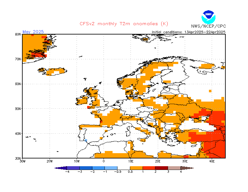
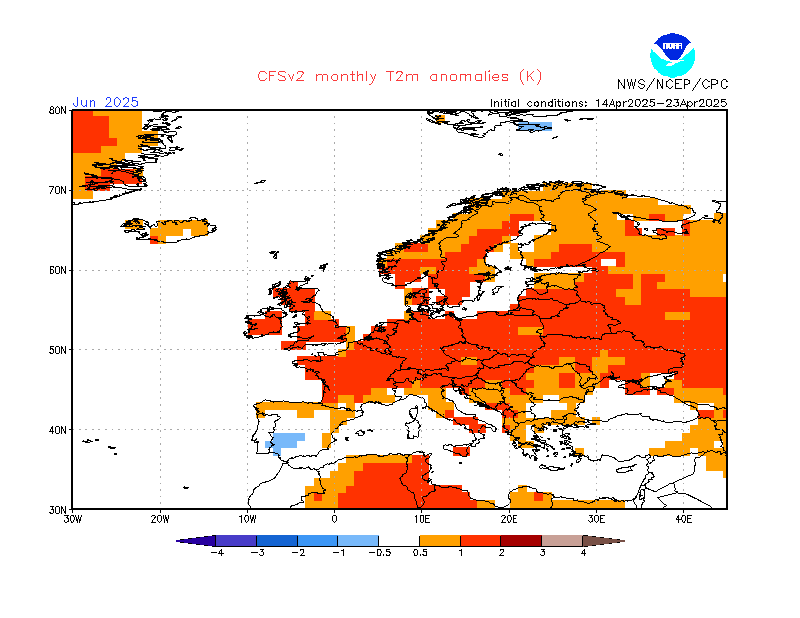
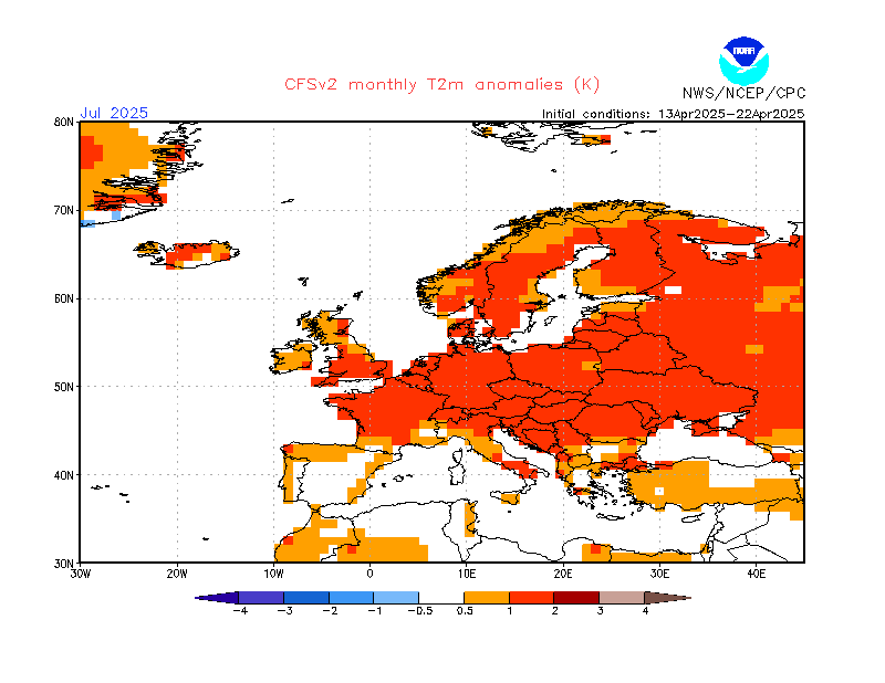
CFS Monthly 2M Temperature Anomaly Forecast